
Holy Land Map at Time of Jesus: A Practical Guide to Biblical Geography
- The Bible Seminary
- Feb 13
- 16 min read
Imagine trying to understand the American Revolution without a map of the original thirteen colonies. You’d miss the strategic importance of Boston Harbor or the grueling winter at Valley Forge. It’s the same when we read the Gospels. Walking the same dusty roads as Jesus of Nazareth, even in our minds, requires a good map. A holy land map at time of jesus isn’t just a collection of ancient names; it’s a guide to the real-world stage of His life and ministry.
Bringing the World of Jesus to Life with Maps
When you open Matthew, Mark, Luke, or John, you’re not just reading a story; you’re stepping into a specific time and place. The rolling hills of Galilee, the bustling shores of its sea, and the politically charged streets of Jerusalem weren’t just backdrops. They were the very soil in which the Gospel took root. Seeing these places on a map moves the biblical account from an abstract tale to a grounded, historical reality.
At The Bible Seminary, we are convinced that true spiritual formation happens when the heart and mind are connected. A map of the Holy Land does exactly that. It becomes a bridge, helping you explore the political divisions, major cities, and geographical features that shaped every step of Christ's ministry. When you can trace his journeys, your Bible study comes alive in a profound new way.
Why Geography Matters for Faith
Visualizing the world of the New Testament brings incredible depth to your understanding of God's Word. When you trace Jesus's path on a map, you begin to grasp things you might have otherwise missed:
The Physical Demands of Ministry: Consider the long walks from Galilee down to Jerusalem. This was often a multi-day trek on foot, revealing the sheer commitment of Jesus, His disciples, and the crowds of pilgrims who followed Him.
The Context of His Parables: His teachings about shepherds, vineyards, and seeds weren't random. They take on a much richer meaning when you can see the very landscapes that inspired them.
The Strategic Nature of His Mission: Why did Jesus focus so much on towns like Capernaum? A map shows it was a hub of trade and travel—a deliberate choice for spreading the gospel message far and wide.
A holy land map at time of jesus is far more than an academic exercise. It's a powerful tool for discipleship. It helps you see the humanity of Jesus and the tangible world He entered to save. This journey into biblical geography grounds your faith in the soil of history, which is a core part of our mission as we equip leaders to impact the world for Christ. Ready to start exploring?
Getting a Handle on the Political Landscape of Jesus' Time
To truly make sense of a holy land map at time of jesus, you must first understand the layers of power that governed the region. While the Roman Empire was the ultimate authority, the on-the-ground reality was a complex web of local client kings, Roman governors, and deep-seated tensions. This political chaos is the stage on which the New Testament plays out—it’s the reason for the conflicts, the hated taxes, and the trials we read about in the Gospels.
When Jesus was born, a single, formidable ruler was in charge: King Herod the Great. His reign, from 37 B.C. to 4 B.C., physically changed the land with massive building projects, none more famous than his huge expansion of the Second Temple in Jerusalem. But after he died, Rome sliced up his kingdom between his three sons, which created a fractured, and often volatile, political map.
This visual helps us see how geography, history, and faith all come together, giving us a much richer way to read the Bible.
It’s a great reminder that geography isn't just about dots on a map. It’s about grasping the world behind the words, which in turn deepens our faith.
The Three-Way Split of Herod's Kingdom
This division of Herod’s kingdom is a crucial detail for understanding the Gospels. Each new territory had its own ruler and its own political vibe, directly shaping Jesus’s ministry and where He could travel safely.
Let’s take a closer look at how Herod's kingdom was carved up after his death. This table breaks down who got what, and why it matters for the biblical narrative.
Territory | Ruler(s) During Jesus' Ministry | Key Biblical Significance |
|---|---|---|
Judea, Samaria, & Idumea | Herod Archelaus (until 6 AD), then Roman Prefects (like Pontius Pilate) | This is where Jerusalem and the Temple were located. Because it became a direct Roman province, it explains why a Roman governor like Pontius Pilate oversaw Jesus's trial and crucifixion. |
Galilee & Perea | Herod Antipas | This was the heart of Jesus’s ministry. Antipas is the "Herod" who imprisoned and executed John the Baptist (Mark 6:14-29) and who Jesus stood before during His trial (Luke 23:6-12). |
The Northeast Territories | Philip the Tetrarch | Ruling regions northeast of the Sea of Galilee, Philip is mentioned in Luke 3:1 during the time of John the Baptist's ministry. His territory was more Gentile and less politically charged. |
This political patchwork meant Jesus and his disciples were constantly crossing borders and navigating different jurisdictions. It wasn’t a unified country but a collection of adjacent, and sometimes hostile, territories.
Rome's Ever-Present Authority
While these local rulers handled day-to-day affairs, Rome's shadow fell over everything. The sight of Roman soldiers, the burden of Roman taxes (a major source of conflict), and the final legal say of the Roman governor in Judea were constant reminders of who was really in charge.
This situation created a powder keg of religious and nationalistic fervor. Many Jews were desperately hoping for a Messiah who would finally overthrow the Romans and restore a sovereign kingdom like David's. This is vital context for understanding what the crowds expected from Jesus.
When you start to see how the landforms, trade routes, and cities fit together, you begin to appreciate the region's immense strategic importance. For a wider view on this, discussions around the geographical pivot of history and heartland theory offer incredible insights into how geography shapes power.
This knowledge makes the political map come alive. It shows us the pressures and powers that defined the world where Jesus walked, taught, and ultimately offered salvation. Here at The Bible Seminary, we dig deep into this historical context, equipping our students with a solid, well-rounded understanding of Scripture that marries top-tier scholarship with a heart for kingdom service.
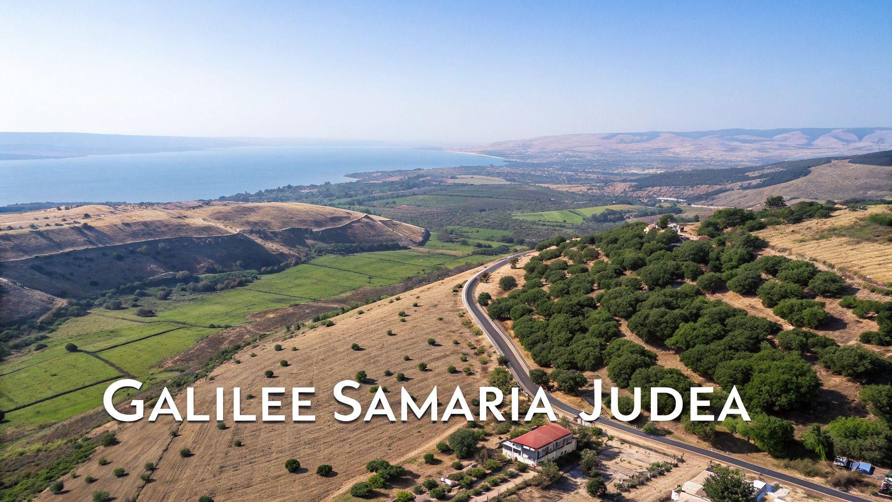
A Journey Through Galilee, Samaria, and Judea
To truly get a feel for Jesus’ ministry, you have to understand the ground He walked on. His work unfolded across three distinct regions, and each one had its own personality and role to play in the Gospels. A holy land map at the time of Jesus shows these aren't just names on a page; they're diverse landscapes that shaped local culture, faith, and how people responded to His message. We'll start in the north, move through a land simmering with tension, and end up in the religious heart of the nation.
Galilee: The Hub of Ministry
Up north, you have Galilee. This was a vibrant, green region where Jesus grew up and began His public ministry. It was known for its rich plains and the bustling Sea of Galilee, a crossroads of cultures thanks to major trade routes crisscrossing the area. The atmosphere here was a bit more relaxed and cosmopolitan than in the south, which made it fertile soil for a radical new message.
This is where it all began. Jesus called his first disciples from the shores of the lake, delivered the Sermon on the Mount, and performed many of his most famous miracles. Towns like Capernaum became his home base, a strategic spot where His teachings could ripple outward. The land itself—the water, the fields, the hills—became the living backdrop for His parables.
Samaria: The Divided Heartland
To get from Galilee down to Jerusalem, one had to go through Samaria. For many first-century Jews, this was enemy territory, a place you’d go out of your way to avoid. The animosity between Jews and Samaritans was ancient and bitter, born from centuries of religious and political strife.
The Samaritans had their own version of the Scriptures and worshiped on Mount Gerizim, not at the Jerusalem Temple. That theological chasm created a massive social barrier.
And yet, this is exactly where Jesus chose to walk. His conversation with the woman at the well in Sychar (John 4) is a stunning example of His mission to tear down walls of hostility. He showed that His message of living water wasn't just for one group—it was for everyone. Knowing this history makes His actions in Samaria all the more powerful.
Judea: The Religious and Political Center
Finally, we arrive in Judea, the southern, drier region that was the absolute center of Jewish life. This was the land of ancient kings and prophets, and of course, home to the holy city of Jerusalem. Its landscape feels starker, more mountainous, a fitting setting for the serious religious and political drama that unfolded there.
Everything in Judea revolved around Jerusalem and its incredible Temple. It was the destination for religious pilgrims and the headquarters for both Jewish and Roman authority. It was here that Jesus confronted the religious establishment, cleansed the Temple, and ultimately faced His trial and crucifixion. The contrast between the open, welcoming crowds in Galilee and the growing opposition in Judea is one of the key tensions you can feel building throughout the Gospels.
The Holy Land during Jesus' time was a compact region, measuring about 150 miles long and 50 miles wide. It split into two main zones: Galilee in the north, a fertile plain with trade routes, and Judea in the south, more mountainous and arid around Jerusalem. The holy city itself was tiny, encircled by walls covering just under one square mile. Travel between Galilee and Jerusalem was arduous; Jesus and his disciples often took the Jordan Valley route via Jericho to avoid Samaritan lands. For students at The Bible Seminary, grasping these dimensions illuminates New Testament travels, enriching studies of Scripture and the artifacts in our 3J Museum.
Understanding these regional differences is absolutely essential. It explains why Jesus’ message landed so differently from one place to the next. Archaeology keeps bringing these ancient sites into sharper focus, demonstrating again and again how the Bible comes alive when we connect the Scriptures to the physical world they describe.
Mapping the Key Cities of Jesus' Ministry
More than just wide-angle views of Galilee, Samaria, and Judea, the Gospels zoom in on specific towns and villages. These aren't just backdrops for the story; they are the actual places where Jesus lived, where He taught, and where His miracles turned the world upside down. When you pinpoint these locations on a holy land map at time of Jesus, you start to trace the footsteps of the Savior, watching the biblical narrative unfold in real space and time.
We can follow this journey from the quiet Galilean village where He grew up to His bustling ministry base on the lake. We can see Him in the prophesied town of His birth and ultimately in the holy city of His death and resurrection. Here at The Bible Seminary, we believe that connecting the text to tangible places is absolutely essential. It’s a core part of our mission, especially in our hands-on archaeology programs that make the world of the Bible come alive.
Nazareth: The Overlooked Hometown
Nazareth is where Jesus spent the first thirty years of his life. Tucked away in the hills of Lower Galilee, it was a small, unassuming village—so insignificant, in fact, that it never gets a mention in the Old Testament, the Talmud, or even the writings of Josephus. For a long time, this historical obscurity led some critics to question if it even existed.
Archaeology, however, has since settled that debate. Excavations have revealed first-century houses and pottery, painting a picture of a humble hamlet with perhaps 50 houses. This small-town reality gives Nathanael's skeptical question—“Can anything good come out of Nazareth?” (John 1:46, ESV)—a whole new layer of meaning. Jesus’s simple origins were a key part of God’s plan, a powerful reminder that His kingdom often begins in the most unexpected places.
Capernaum: Ministry Headquarters on the Sea
If Nazareth was His childhood home, Capernaum became Jesus’s adult headquarters. This thriving fishing village on the northern shore of the Sea of Galilee was a hub of activity. Its strategic spot on a major trade route made it the perfect basecamp for His teachings to spread far and wide.
Jesus taught in the Capernaum synagogue, called His first disciples from its shores, and performed countless miracles right there in its streets.
“And they went into Capernaum, and immediately on the Sabbath he entered the synagogue and was teaching. And they were astonished at his teaching, for he taught them as one who had authority, and not as the scribes.” — Mark 1:21-22 (ESV)
Even today, you can visit the ruins of a first-century synagogue and a house widely believed to have belonged to Peter’s family. Standing there provides a powerful, tangible connection to the Gospel accounts.
Bethlehem: The City of David's Heir
Bethlehem, a small Judean town just south of Jerusalem, carries immense prophetic weight. It was the ancestral home of King David and, more importantly, the place Micah 5:2 prophesied would be the Messiah’s birthplace. The Gospels of Matthew and Luke faithfully record Joseph and Mary’s journey there for a Roman census, where Jesus was born.
Though His family would soon relocate to Nazareth, Jesus's birth in Bethlehem was a direct fulfillment of Scripture, powerfully identifying Him as the promised heir to David's throne. This tiny town remains a testament to God's faithfulness in keeping His covenants.
Jerusalem: The Holy City of Climax
Jerusalem was the undisputed center of Jewish religious and political life. The entire city was oriented around the magnificent Temple, the place where God's presence was said to dwell and where pilgrims flocked for the major festivals. For Jesus, it was the city of ultimate confrontation and divine purpose.
Here, He taught in the Temple courts and challenged the religious authorities. Here, He shared the Last Supper with His disciples and prayed in the Garden of Gethsemane. Most critically, it was in and around Jerusalem that He was arrested, tried, crucified on Golgotha, and buried. His resurrection from a tomb just outside the city walls three days later changed history forever. Jerusalem is both the geographic and theological climax of the Gospels—the very place where salvation was accomplished.
How Natural Features Shaped Life and Parables
The physical geography of the Holy Land wasn’t just a static backdrop for the Gospels; it was an active participant in the story. When you look at a holy land map at time of Jesus, you see a land of dramatic contrasts that directly influenced daily life, travel, farming, and even the very language of faith.
Understanding these features adds a rich, tangible layer to Scripture. It helps us see exactly why Jesus taught the way He did. Here at The Bible Seminary, we believe grounding Scripture in its physical context is essential to unlocking its full meaning. The stark differences between environments—from the lush shores of Galilee to the barren Judean wilderness—provided powerful, everyday metaphors that Jesus used to communicate profound spiritual truths.
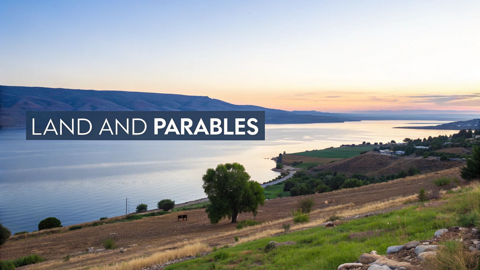
The Life-Giving Sea of Galilee
The Sea of Galilee, a large freshwater lake in the north, was the vibrant heart of Jesus’ ministry. It was a source of life and livelihood, supporting a bustling fishing industry and numerous lakeside towns like Capernaum and Tiberias.
But its waters could also be treacherous. Calm and beautiful one moment, dangerously stormy the next—a reality the fishermen disciples knew all too well. This volatile nature provided the perfect setting for incredible miracles, like when Jesus calmed the storm (Mark 4:35-41) or walked on the water (Matthew 14:22-33), powerfully demonstrating His authority over creation itself.
The Jordan River and the Wilderness
Flowing south from Galilee, the Jordan River acts as the geographical spine of the Holy Land. It cuts through a deep rift valley, creating a distinct corridor that ends in the Dead Sea. This river holds immense spiritual weight as the site of Israel’s entry into the Promised Land and, centuries later, John the Baptist’s ministry and Jesus’ own baptism (Matthew 3).
To the east and west of the Jordan Valley lies the Judean Wilderness. This arid, rugged landscape was a place of testing, solitude, and raw dependence on God. It was here that Jesus fasted for 40 days and faced temptation (Matthew 4:1-11), far from the comforts of village life. Our understanding of biblical geography is often deepened by archaeological work, such as the ongoing discoveries at Mount Ebal, which continue to illuminate the historical context of Scripture.
Contrasts That Taught Powerful Lessons
The geographical contrasts of the Holy Land are truly stunning. The region spanned from the snow-capped peak of Mount Hermon (over 9,000 feet) to the Dead Sea, the lowest point on earth at roughly 1,300 feet below sea level. Jerusalem itself sits high in the hill country at about 2,540 feet. The rainy season from November to March would green the central hills for terrace farming, but by summer, the lands south and east of Jerusalem turned into a parched desert.
This dramatic, ever-changing landscape provided Jesus with a rich vocabulary for His parables.
The parables of sowing seeds on different types of soil (Matthew 13) or building a house on rock versus sand (Matthew 7) were not abstract ideas. They were drawn directly from the visible realities of the land, making His teachings unforgettable for a first-century audience.
These features also dictated travel. A journey from Galilee down to Jerusalem covered about 90 miles and could take 3-5 days along the Jordan Valley route—a path many Jews took to avoid passing through Samaria. Understanding this doesn't just fill in a map; it helps us appreciate the physical commitment it took to follow Jesus. It transforms our reading of the Bible from a flat page into a more immersive, grounded experience, training both our hearts and minds for kingdom service.
Using Biblical Maps to Deepen Your Bible Study
Studying a holy land map at time of Jesus is much more than a dry academic exercise. It's an active, faith-enriching practice. When you open your Bible with a map sitting right next to it, you're not just reading words on a page anymore—you're stepping into the world of the text in a completely new way.
Reading the Gospels suddenly transforms from a familiar story into an immersive experience. You can trace Jesus’ journeys from the rolling hills of Galilee down to the imposing city of Jerusalem. You can visualize the real-world settings of His parables and get a feel for the realities of first-century travel. When you place events on a map, you begin to see the strategic and deeply intentional nature of Jesus' ministry.
Here at The Bible Seminary, this is what we are all about: equipping leaders to understand the Bible in its full context. Learning to navigate its world isn't just a neat trick; it's a foundational skill for truly impactful ministry.
From Text to Terrain
Making the connection from the biblical text to the actual terrain is one of the most powerful ways to bring Scripture to life. It helps you ask better questions and, in turn, find much richer answers.
When you see just how close Cana was to Nazareth, the wedding feast miracle feels more intimate, more local. When you trace the long, dusty road to Jerusalem for the Passover, the commitment of the pilgrims becomes so much more tangible.
The real goal of integrating geography into your study is to close the distance between their world and ours, making the biblical narrative feel immediate and personal. It’s about uniting scholarship with spiritual formation, a core value we cherish.
This practice grounds your faith in the very soil of history and geography. For a deeper look into that historical context, it's also incredibly helpful to understand how scholars approach ancient texts in the first place. You can learn more by exploring the methods used for deciphering ancient languages and how they unlock the past.
Practical Steps for Studying with a Biblical Map
So, how do you actually start doing this? It’s simpler than you might think. We have put together a few actionable steps to get you started, whether you're preparing a lesson, leading a small group, or in your personal devotion time.
Action Step | Description | Example Application |
|---|---|---|
Trace the Journey | When reading a Gospel narrative, follow Jesus’ movements on a map. Note the distances, terrain, and regions He passes through. | Follow Jesus' final journey from Galilee to Jerusalem in Luke 9-19, noting the shift as He moves from familiar territory toward His ultimate purpose. |
Visualize the Parables | Locate the settings where Jesus taught. Consider how the local environment (e.g., farming, fishing, shepherding) influenced His illustrations. | When reading the Parable of the Sower (Matthew 13), visualize the rocky soil of the Galilean hillsides versus the fertile ground near the lake. |
Identify Strategic Locations | Notice where key events happen. Why Capernaum? Why Jerusalem? Consider the political, religious, and economic importance of each city. | Observe how much of Jesus' ministry is centered around Capernaum, a major trade hub on the Sea of Galilee, ideal for His message to spread. |
Integrating maps isn't about adding another complicated step to your study routine. It's about opening a new window into the world of the Bible, one that makes the people, places, and events more real than ever before. Give it a try—you might be surprised at the fresh insights you uncover.
Answering Your Questions About Maps of Jesus' Time
Let's tackle some of the most common questions that come up when you start exploring the geography of the New Testament. Getting clear on these points can really deepen your understanding of the world Jesus lived and ministered in.
What Was the Holy Land Called in Jesus' Time?
During Jesus' ministry, the region actually went by several names, depending on who was speaking. The Romans, for administrative purposes, often called the larger province Judaea (spelled Iudaea).
However, for the people living there, it was more common to refer to the distinct regions they called home: Galilee, Samaria, and Judea. The name "Palestine" (Palaestina) was only formally applied by the Romans to the whole area much later, after the Bar Kokhba revolt in 135 AD, though the name itself had older roots with Greek historians.
How Far Was the Journey From Galilee to Jerusalem?
The trip from a central spot in Galilee, say Nazareth, down to Jerusalem was a significant undertaking. The distance was roughly 70-90 miles, but the exact mileage depended on the chosen route.
Because of long-standing tensions, many Jewish travelers would take the longer path through the Jordan Valley and Perea, deliberately avoiding Samaria. This was a walking journey that would typically take three to five days, which highlights the commitment it took for pilgrims heading to Jerusalem for the major religious festivals.
Why Did Jewish Travelers Often Avoid Samaria?
The animosity between Jews and Samaritans was rooted deep in history and religious disagreements. The Samaritans had their own version of the Torah and a rival temple on Mount Gerizim. In Jesus' day, most orthodox Jews viewed them as having a compromised, illegitimate form of worship.
This long-standing hostility is exactly why it was so stunning for Jesus to travel through Samaria and minister there, as we read in John 4. His actions intentionally shattered the powerful social and religious barriers of his day.
Where Can I Find Reliable Maps of the Holy Land?
Many quality study Bibles come with detailed maps that are a fantastic starting point for personal study. For those who want to go deeper, resources like the ESV Study Bible Atlas and the Zondervan Atlas of the Bible offer historically precise maps grounded in solid scholarship.
Here at The Bible Seminary, our archaeology programs and the 3J Museum of Biblical Archaeology take it a step further. We offer curated resources and exhibits that bring these maps to life with physical artifacts from the period. It’s one thing to see a map; it’s another to see the world of the Bible in a new way, connected to the objects people actually used.
At The Bible Seminary, we are passionate about uniting scholarship with spiritual formation. If you're ready to deepen your understanding of God's Word in its historical context, we invite you to explore our degree and certificate programs. Learn more about our academic programs at The Bible Seminary.